
Városgazda municipal GIS
A map based online system that supports the daily work of municipalities.
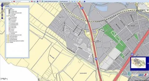
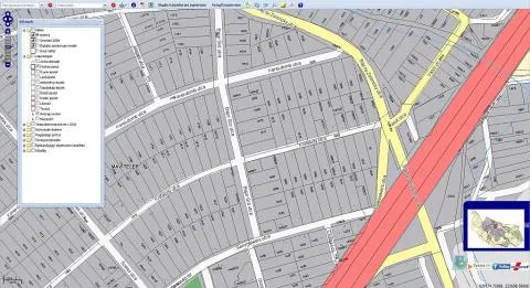
Városgazda is a map based online system that supports the daily work of municipalities
The VÁROSGAZDA system supports:
- municipal asset management through keeping the asset register,
- informing residents through a map based website,
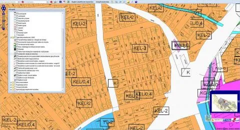
- the work of the building authority, by keeping zoning and development plans up to date and comparable with the base map, and by connecting to the existing building authority system,
- tax administration, by providing suitable base maps,
- utility coordination, by making utility maps and the land registry map comparable,
- environmental matters, by making environmental data public,
- the marketing and licensing of tourist sites,
- road management tasks that fall under municipal competence, by giving a clear picture of road condition,
- public space and green area management, by showing the spatial relations of the related data,
- cooperation with partner towns at home and abroad, and building a common system for micro regions and municipal associations.
Steps of introduction
Needs assessment
The needs assessment takes place at the municipality as on site interviews with the heads of the departments concerned. It results in a plan that describes, in terms the user understands:
- the data managed by VÁROSGAZDA, its source, update cycle and cost,
- the functions used by each department, from the user’s point of view,
- how VÁROSGAZDA works together with other existing or planned systems,
- the acceptance criteria that support handover.
Data acquisition and survey
The loaded data falls into three groups:
- Municipalities have accumulated a huge body of data that cannot work for the town and its residents, because it is scattered, on paper, in places that are hard to reach.
- State institutions collect a lot of data of public interest and make it available to municipalities free of charge. Examples are environmental data, which show the state of the local environment and the loads on it, and the data of the utility network.
- Some important data is paid, and we recommend acquiring it. This is above all the land survey base map and the most recent aerial images.
Merging and cleaning data and maps
We give the databases a uniform structure and load them into a database that can receive map data.
Development and customisation
The basic functions are ready. Only the special workflows the municipality needs, or links to other systems the municipality already has, need to be developed. 90 percent of requirements can be met by customisation.
Installation, testing, fine tuning and training
We install the system and the municipality tests it against the acceptance criteria. We fine tune the system according to the test results and train the staff of the different departments. On request we also hold a presentation for residents.
Operation
- The system can be run in house. This needs a mid range server, which can be an extension of an existing one.
- It can also be operated as hosting on the contractor’s server, for a monthly fee.
Data maintenance and updates
The steps above can be repeated cyclically as new needs arise. We believe in building step by step, in the fact that an organisation needs time to take in even the first functions, and that the system is worth developing further only after the organisation has accepted it.
Costs
Installed system (own server)
- The cost of the base software, operating system, database manager and special GIS software can be 0 HUF if free, open source software is used.
- Development and customisation.
- Operation, which includes server supervision, system support and loading updated data.
- The cost of updating data, if paid data has been loaded into the system.
- The cost of the server computer, or the extension of an existing server.
System provided from the contractor’s server (ASP, SaaS)
- The cost of the base software, operating system, database manager and special GIS software is 0 HUF, because we use free, open source software.
- Customisation, if further needs exist beyond the basic functions.
- Operation, which includes hosting the application and data on the contractor’s server, supervision, system support and loading updated data.
- The cost of updating data, if paid data has been loaded into the system.
With the provided service it is possible to reach 0 HUF investment cost, and to subscribe to the system for a monthly fee under a long term agreement.
Let us talk about your project
If one of our solutions interests you, or you have a special requirement, write to us or call our colleagues.
Contact