
AI geospatial query
Ask your geospatial data questions in plain language
We don't replace your GIS. We build on the data you already own and add a chat interface to it.
Request a free proof of conceptHow it works
- Data
- Oracle · PostgreSQL/PostGIS · ArcGIS · files
- Models
- Claude · OpenAI · Gemini · local models
The data is there, the answers are late
- The data is there, but only GIS specialists can query it.
- A simple question waits days in the queue.
- New systems are expensive and risky to introduce.
How it works
We don't replace your GIS. We add one layer between your existing database and your colleagues.
We connect to your existing database.
Read-only access. No migration and no copying, unless you ask for data integration.
We set up permissions and sensitive data.
Who can see which layers and columns, and what must never leave your network.
Your colleagues ask, the system answers.
In text, tables and interactive maps, with the query steps shown, so every number can be checked.
What you get, and what you keep
Keep your GIS
Nothing is replaced or migrated. The AI layer sits next to the system you already run.
Built on your data
Answers come from your own database through live queries, not from an external copy.
Chat with your database
Ask in plain language, get a number, a table or a map. You can see which query produced the result.
Access control stays
We build on your existing SSO (Azure AD/Entra ID, Keycloak, LDAP), or provide our own user management.
Privileges per role
Everyone reaches only what they need, by layer, column and area.
Sensitive data stays inside
Flag the data that must never leave your network. The system never sends it to an external model.
Learns from feedback
Users report wrong or missing answers with one click, and the system learns to answer them.
Any model
Claude, OpenAI, Gemini or an open model running locally. No lock-in to one vendor.
Every answer audited
Before answering, the system checks for personal and sensitive data, shows the result in the answer and logs it.
Your data stays yours
This section is for IT and data protection officers, because these questions usually decide public-sector purchases.
- Read-only database connection. The AI cannot modify data.
- SSO integration or our own authentication.
- Role-based privileges down to layer, column and area level.
- A sensitive flag on tables and columns. Flagged data never leaves your network. With a local model, nothing leaves at all.
- Deployment on your own servers or in the cloud, hosted in the EU.
- Audit log: every question, user, executed query, issue found and action taken is logged, and can be exported for your DPO or auditor.
A compliance check in every answer
Before an answer is shown, the system checks whether it contains
- personal data under GDPR (names, addresses, ID numbers, owner data linked to parcels, small-area statistics that could identify a person),
- data your organisation has flagged as sensitive,
- data outside the user's privileges.
Depending on the rule, the issue is flagged in the answer, the affected fields are masked or aggregated, or the answer is refused with an explanation.
Question: Who owns the parcels in zone 2?
Audit: GDPR, personal data (owner name). Based on your privileges: aggregated.
Answer: 412 parcels, owned by 368 private persons and 44 companies. Names are not shown.
Logged: 2026-11-17 10:42 · user · query · action: aggregated
Works with the database you choose
- Databases
- Oracle (Spatial)PostgreSQL/PostGIS
- GIS platforms
- ArcGIS EnterpriseArcGIS Online
- Files
- ShapefileGeoPackageGeoJSONCSVExcel
- Models
- ClaudeOpenAIGeminilocal open-weight models
- Deployment
- on-premiseprivate cloudour cloud
Data integration on request. If your data is spread across systems, we connect them so they can be asked together.
What it looks like in practice
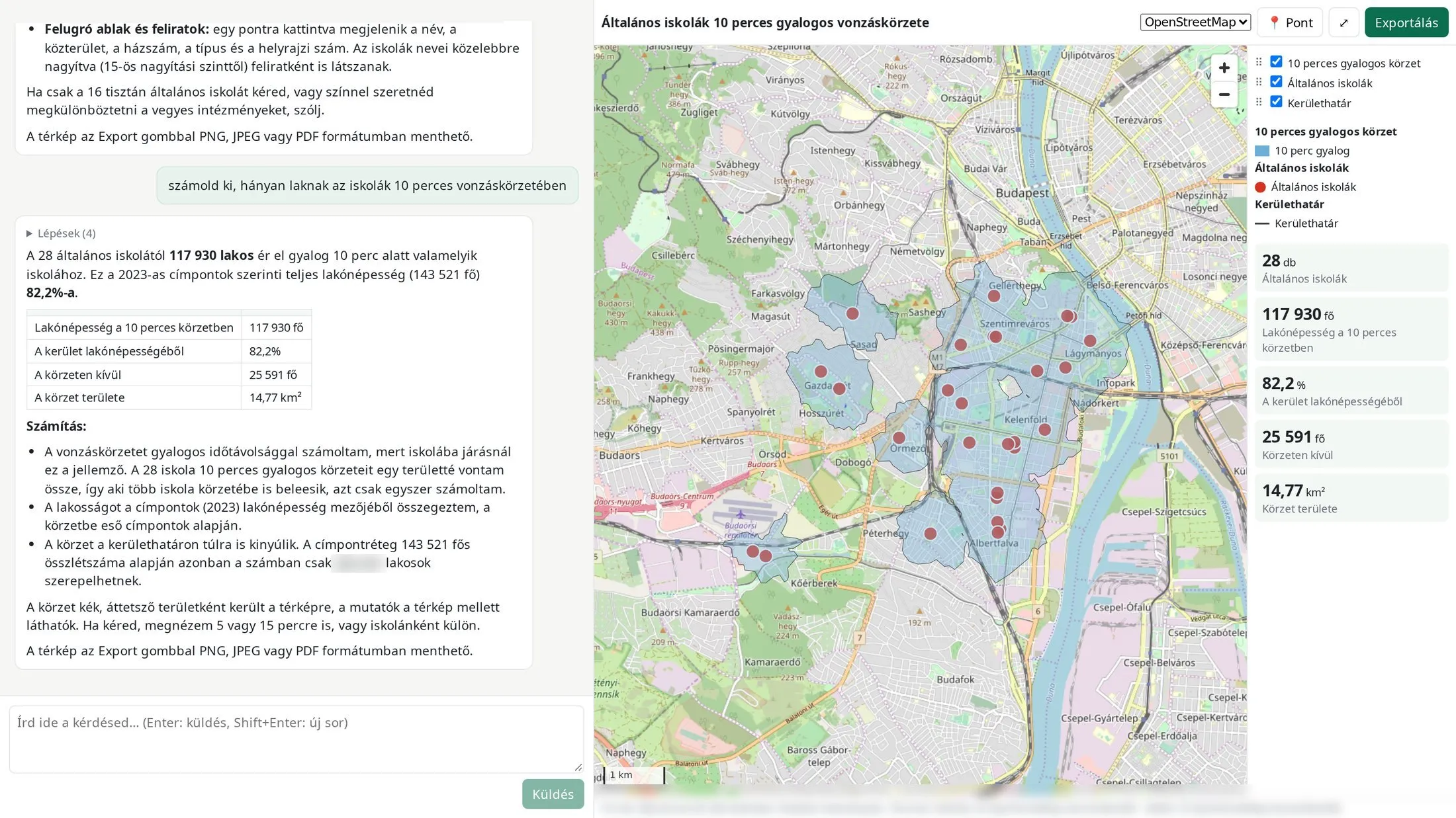
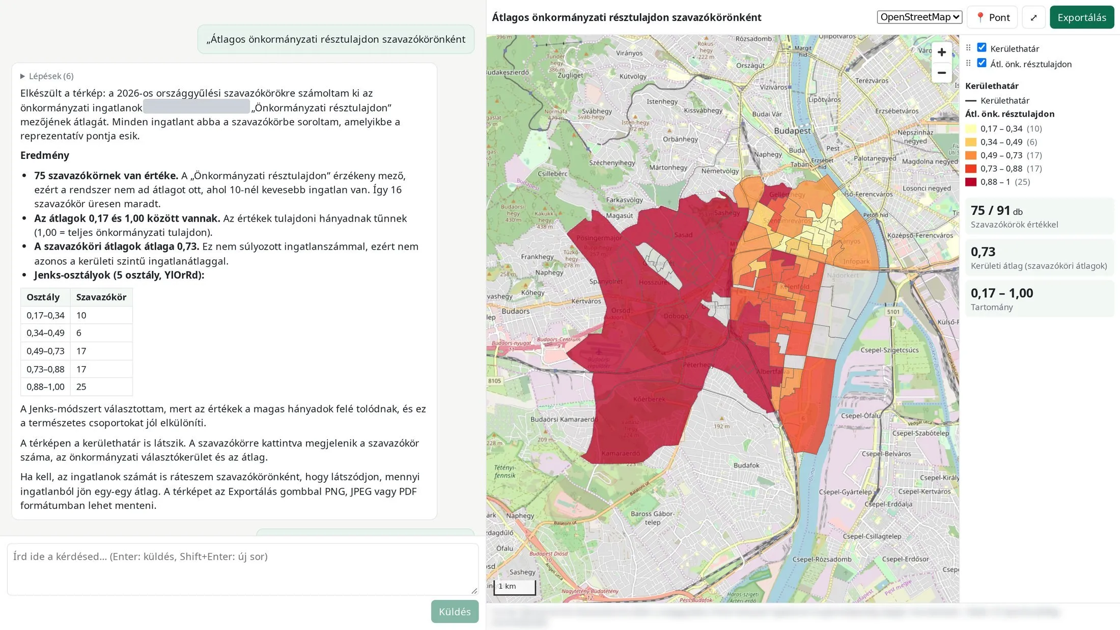
Real questions and answers from a municipal GIS database (the interface is in Hungarian). Maps can be shared by link and saved as PNG, JPEG or PDF. The client's name and the source line are blurred. Map background: © OpenStreetMap contributors.
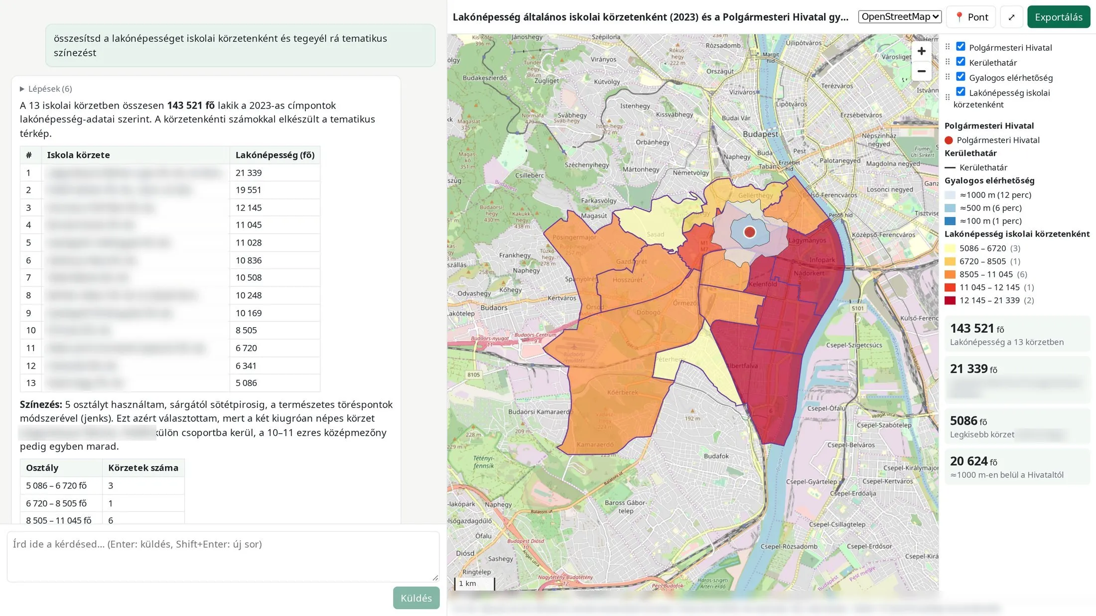
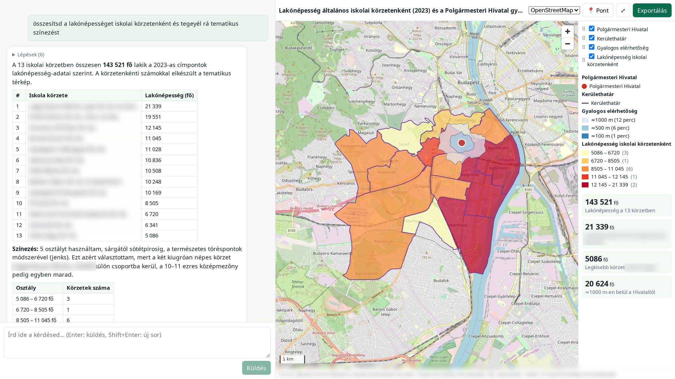
Question: „Sum the residents per school catchment and add a thematic colouring.”13 catchments, residents per catchment, coloured in five classes. The answer explains why it chose the method. 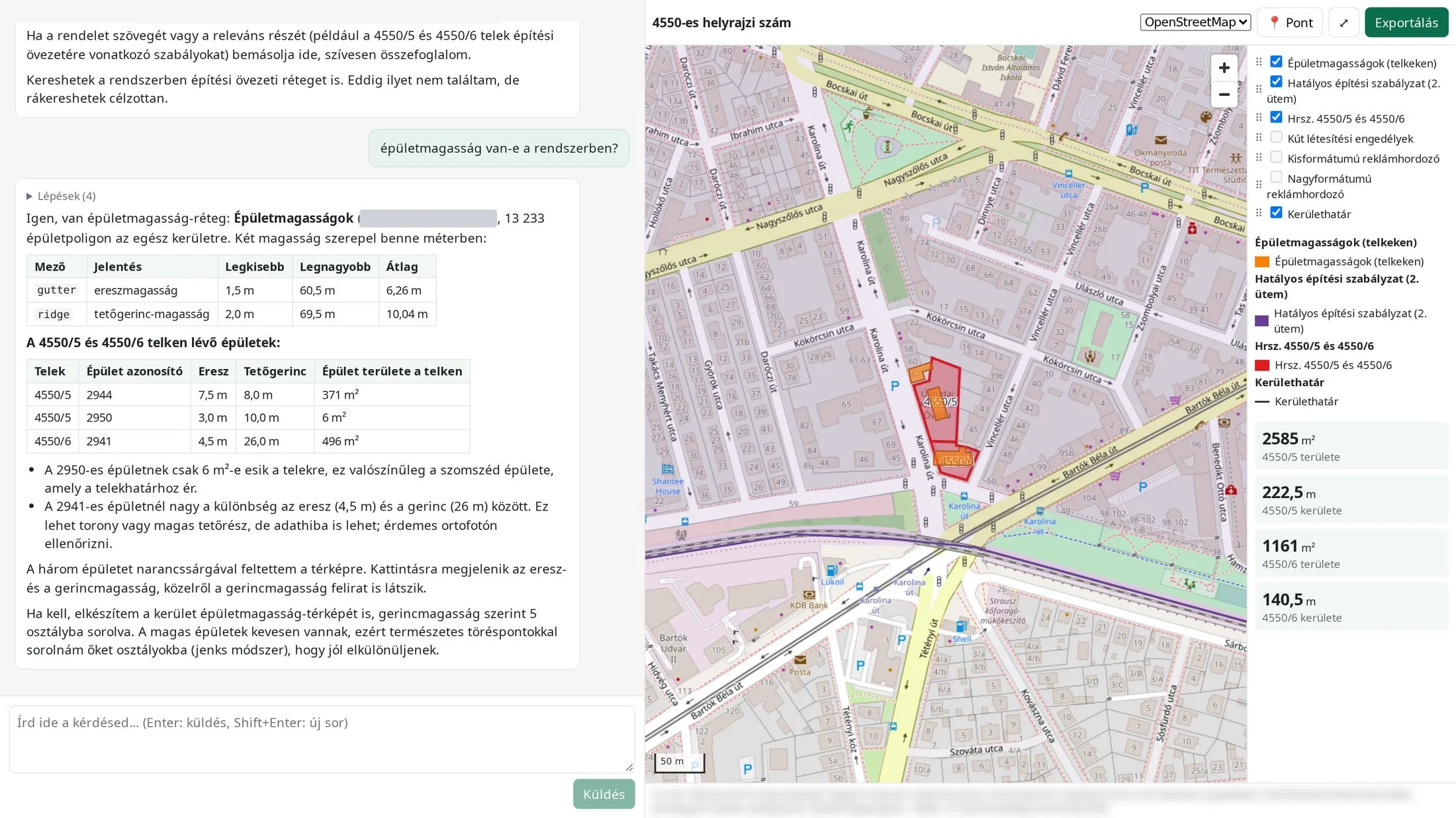
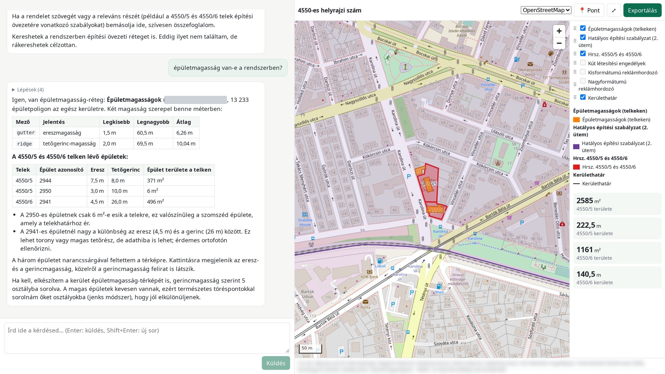
Question: „Is there building height data in the system?”Finds the right layer, calculates the eaves and ridge heights of the buildings on two parcels, and flags a suspicious value. 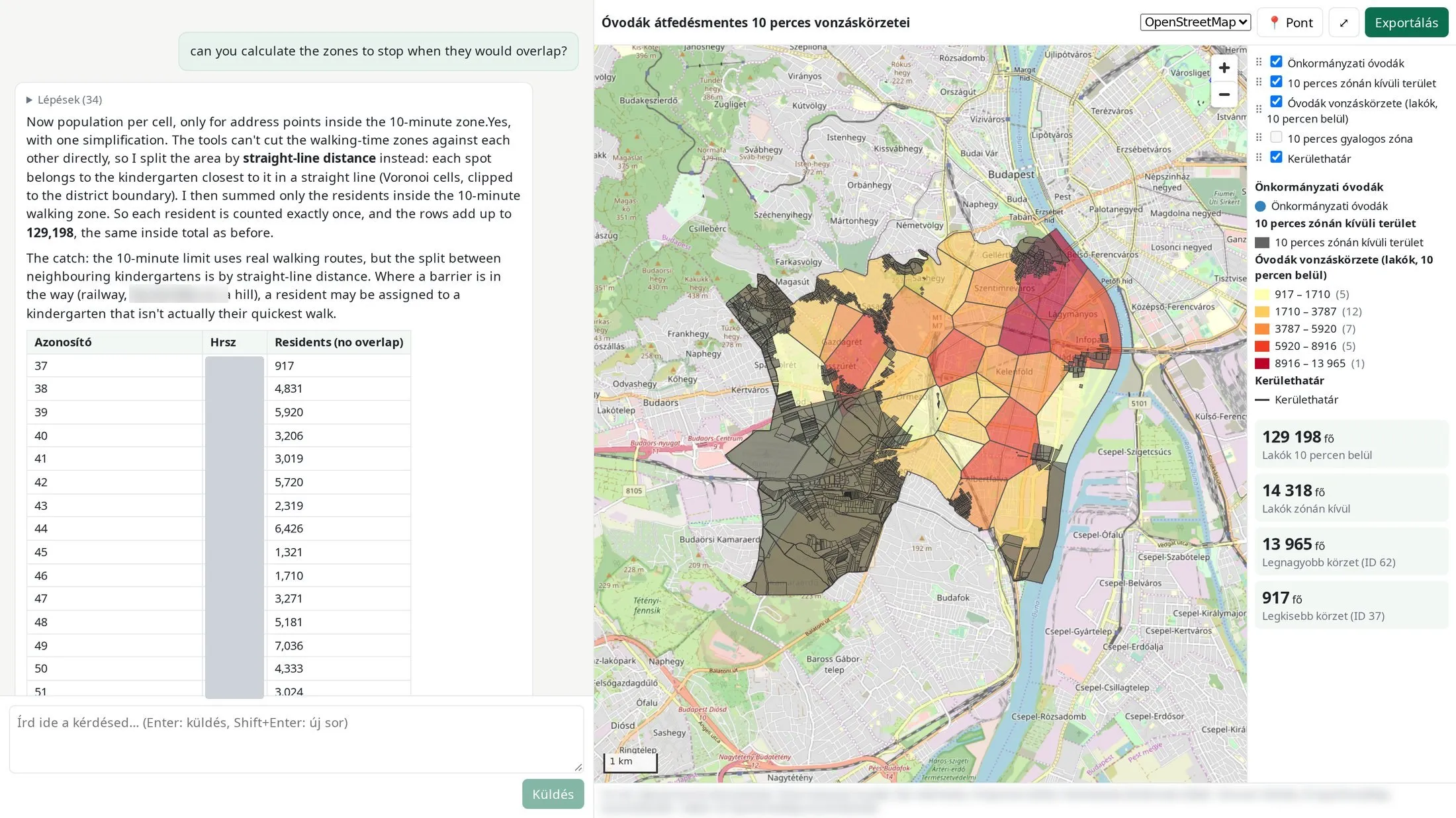
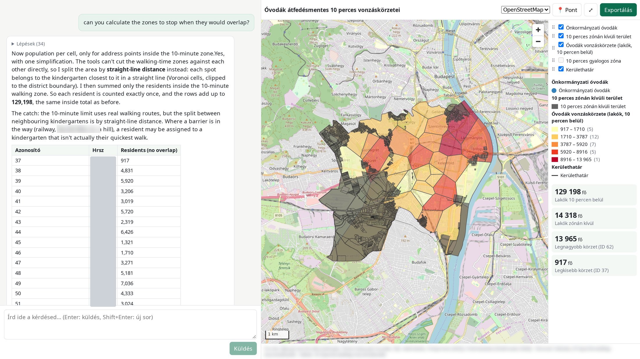
Question: „Can you calculate the zones to stop when they would overlap?”Non-overlapping kindergarten catchments with resident counts. The answer also explains the limits of the method. 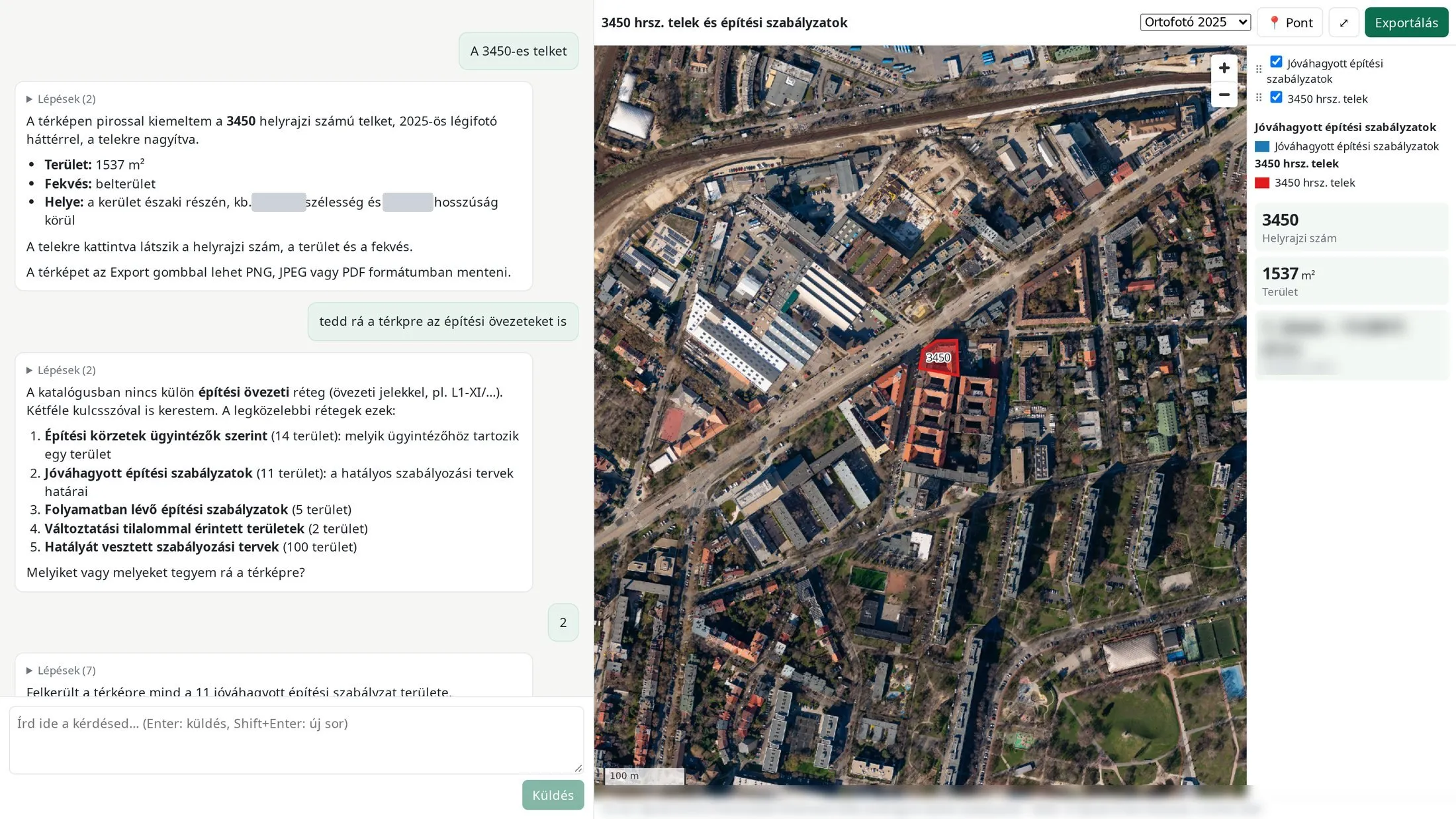
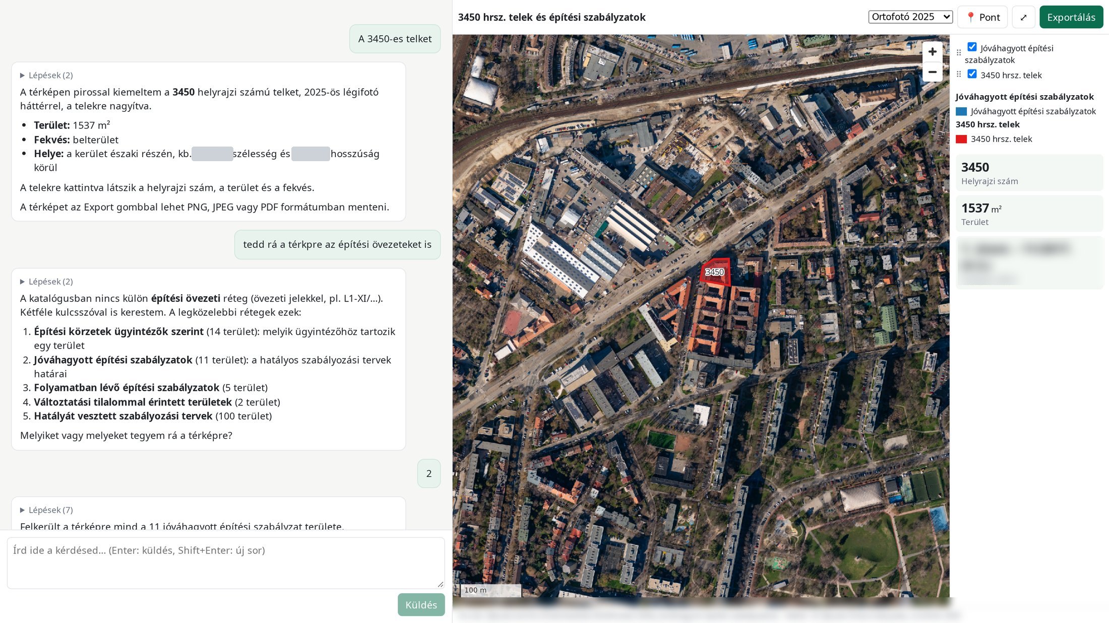
Question: „Show parcel 3450, and add the building zones to the map.”When the requested layer is not in the catalogue, it offers the closest ones and asks which to add. 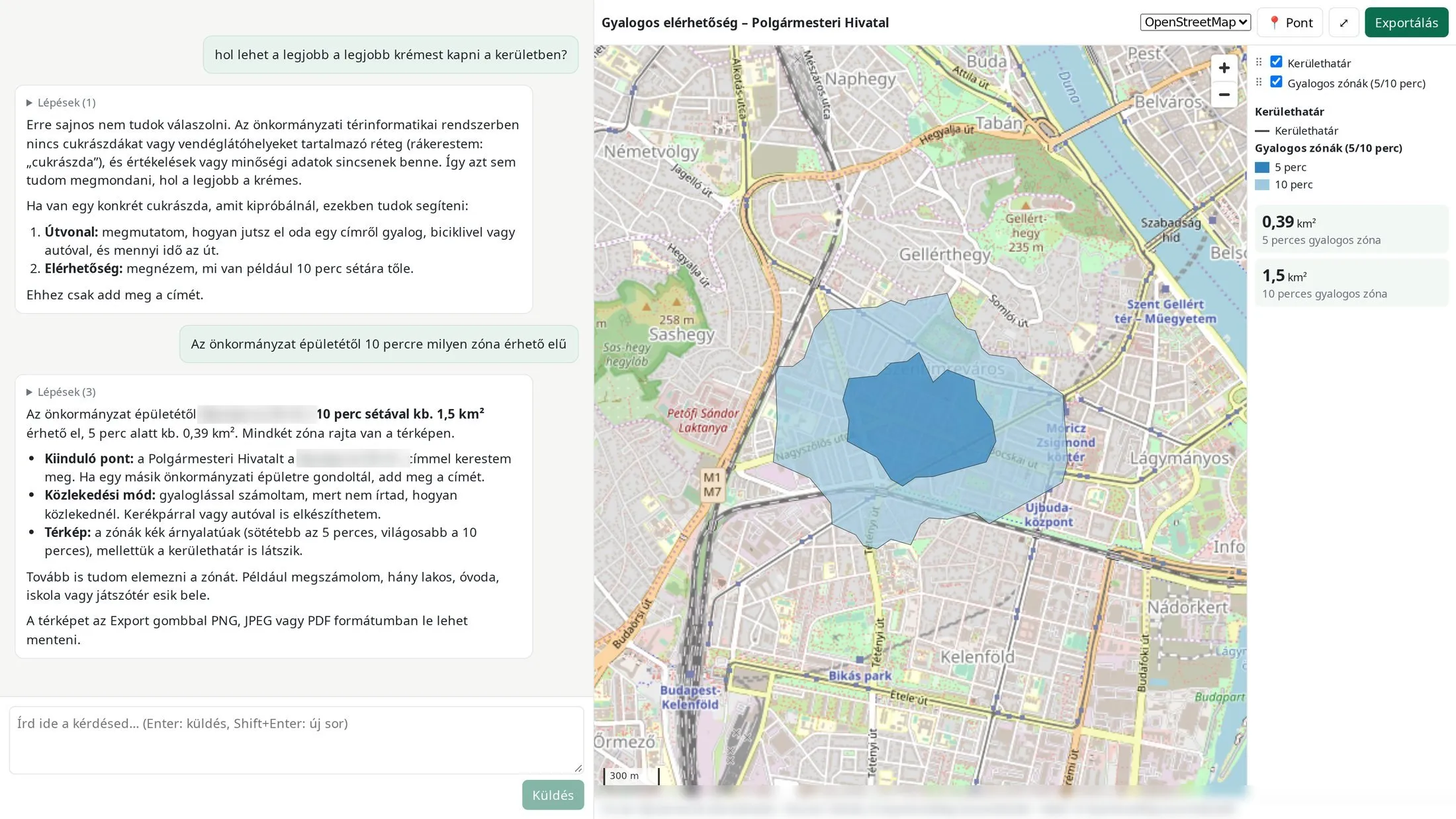
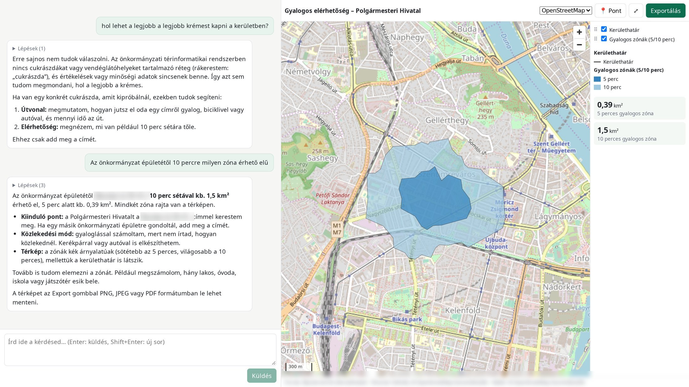
Question: „Where can I get the best custard slice in the district?”When there is no data, it does not make up an answer. It says what it can do instead, for example a 10 minute walking zone.
Example questions by sector
- Municipality„How many properties are in the downtown zone, and what is their total value per electoral district?”
- Utilities„Which pipe sections are older than 30 years within 500 m of a hospital?”
- Health, civil protection„What area can be reached within 5 and 10 minutes from hospital no. 2, and how many people live there?”
- Asset management„Show the commercial parcels on a map by land use.”
A smooth introduction
GIS data-flow survey
Before setup we map how geospatial data is created, stored and used in your organisation, and what counts as sensitive. This makes the introduction quick and predictable.
Free proof of concept
On a selected dataset, with real questions from your colleagues.
Rollout
Connection, permissions, sensitive-data rules, SSO.
Continuous improvement
Feedback on wrong or missing answers improves the system.
Simple and predictable
- Free proof of concept
- No development costs
- SaaS subscription, no additional licence fees
- On-premise or cloud, same model
Priced separately, on request: data integration, local LLM hardware.
Frequently asked questions
Do we have to replace our GIS?
No. It sits next to the system you already have.
Will our data go to the cloud?
Only what you allow. Data flagged as sensitive never does, and with a local model nothing does.
Which AI model does it use?
The one you choose: Claude, OpenAI, Gemini or a local model. You can switch later.
Who can see what?
Privileges come from your SSO or our own user management, broken down by layer and column.
How do I know if an answer contains personal or sensitive data?
Every answer is audited. The system checks for personal data under GDPR and for data flagged as sensitive, shows the result in the answer and logs it. Depending on the rule, it masks, aggregates or refuses.
What if it gives a wrong answer?
The query is shown next to the answer, so it can be checked. You can report a wrong answer with one click, and the system learns from it.
How much does it cost?
The proof of concept is free. After that, a SaaS subscription with no development or licence costs.
How long does the introduction take?
A proof of concept usually takes 2–4 weeks. The full rollout depends on the number of data sources and the permission rules, and we give an exact figure after the survey.
What hardware does a local model need?
We assess your needs, make a recommendation and can supply the hardware on request.
Try it on your own data, free
Tell us which database you use and what your colleagues want to know.